top of page

Recreational Fishing Area 5 (Annapolis, Hants & Kings Counties)
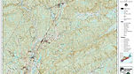
Select the grid square for where your angling location will be. This will launch a more detailed map. Zoom into the area where you plan to fish for this program and record the grid code. Codes consist of a sequence of 7 numbers and digits. The first number will indicate your Recreational Fishing Area. These codes will allow us to track data from the same site over time. E-mail us if you cannot determine your grid square(s)!


bottom of page